The Cognavitron — hover for details · click to navigate · double-click for full size
Golden Eagles — Telemetry and Occupancy
field-ecology
movement
birds
bayesian
spatial-analysis
Long-term telemetry and occupancy modeling for golden eagles (Aquila chrysaetos) in the western US. GPS tracking, movement modeling, habitat modeling, and Bayesian occupancy analysis across a decade of field data.
The Study
I was fortunate enough to play a large role in a GPS telemetry study of golden eagles (Aquila chrysaetos) in southern California. Our focus was on eagle habitat use and response to urbanization in our region. During the course of the study, however, some eagles that we tracked went as far south as Baja California Sur, Mexico and as far north as Alberta, Canada.
This project grew out of a need to understand how golden eagles were using the urban-wildland landscape east of San Diego — a mosaic of chaparral, grassland, oak woodland, and agricultural land and pastures alongside urban and suburban development, roads, and freeways in one of the fastest-growing urban areas in California.
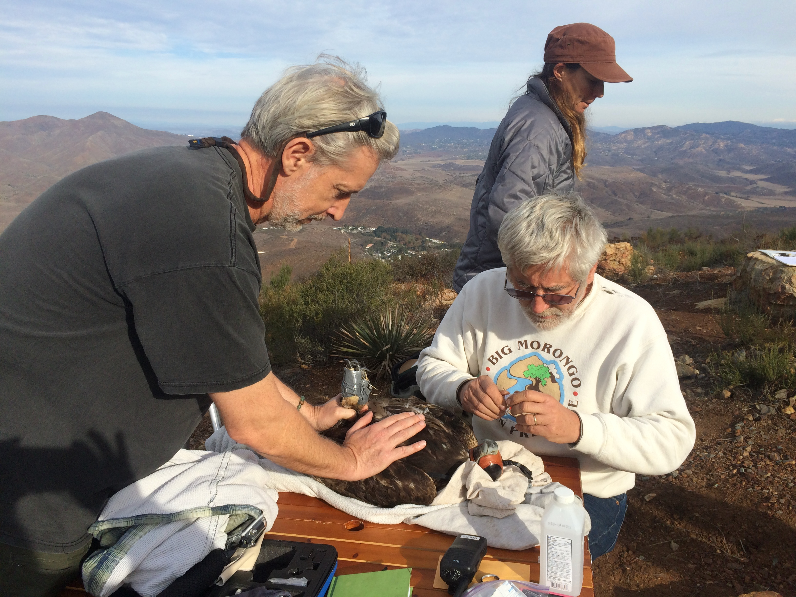
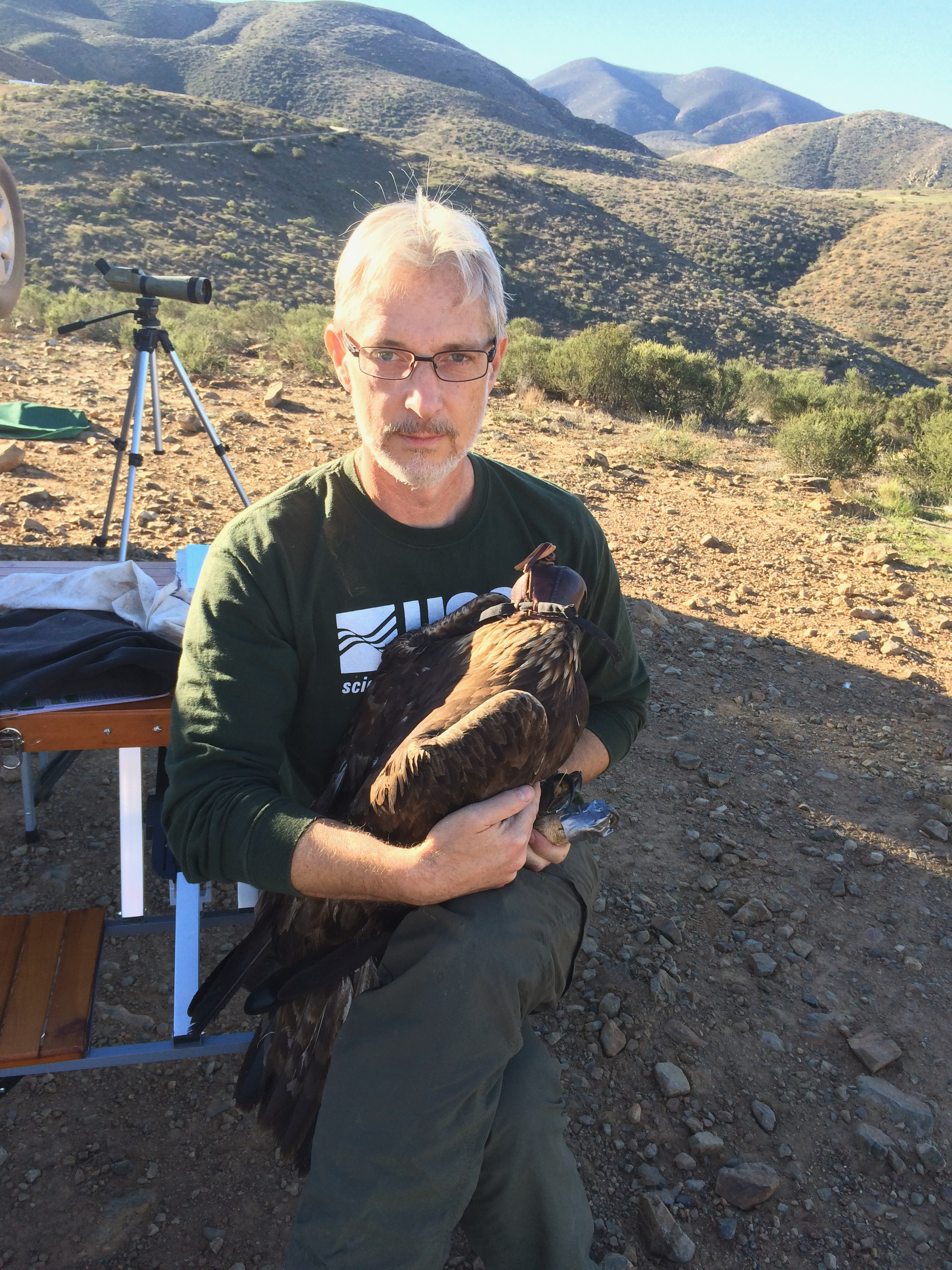
After our team’s PI, Robert Fisher, secured funding for the project, Pete Bloom, Jeremy Sebes (a USGS field technician), and I got the study off the ground in early fall 2014. Pete Bloom — one of the foremost raptor biologists in the western US — led the eagle trapping effort and was involved in all other aspects of the study. Pete’s expertise was essential; capturing a golden eagle requires a lot of technique and experience and, as Pete explained to us, can be hazardous to one’s health if done incorrectly.
For a few years I supervised the field work while also managing the datasets and doing the analysis. Eventually Melanie Madden — an actual bird biologist — took over field supervision, which was exactly right. I shifted fully to data management, modeling, and the computational aspects of the project.
This page is not so much about the study and our findings. It is a story about one Golden Eagle – the first male we captured on Otay Mountain (M001) in December 2014.
Field Methods
We surveyed field sites and set up bait sites with wildlife cameras to monitor for eagles. Once we detected an eagle at a site, a bow net was set up and, when set, was observed continuously so Pete knew when to safely trigger the trap by remote control.
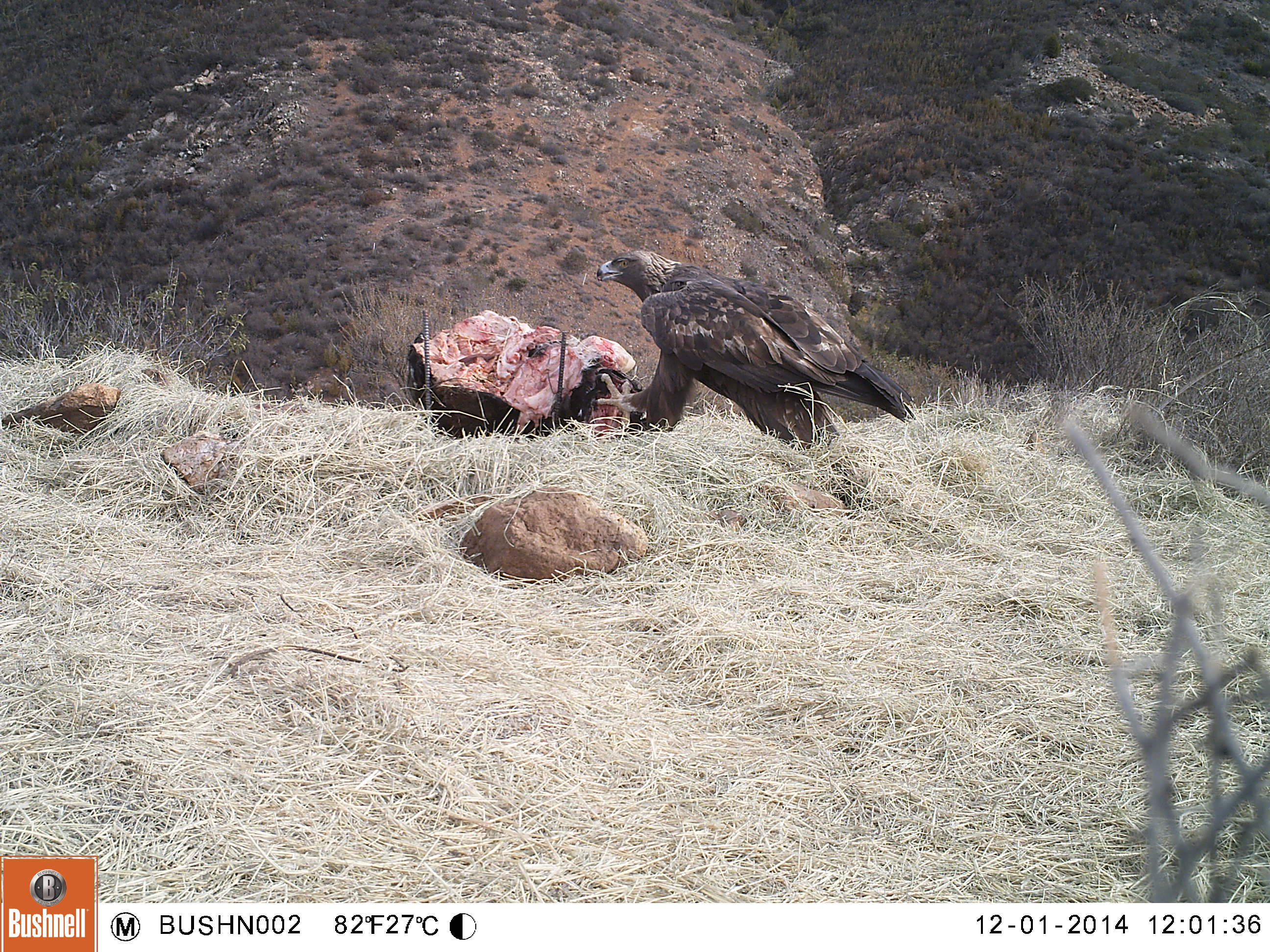
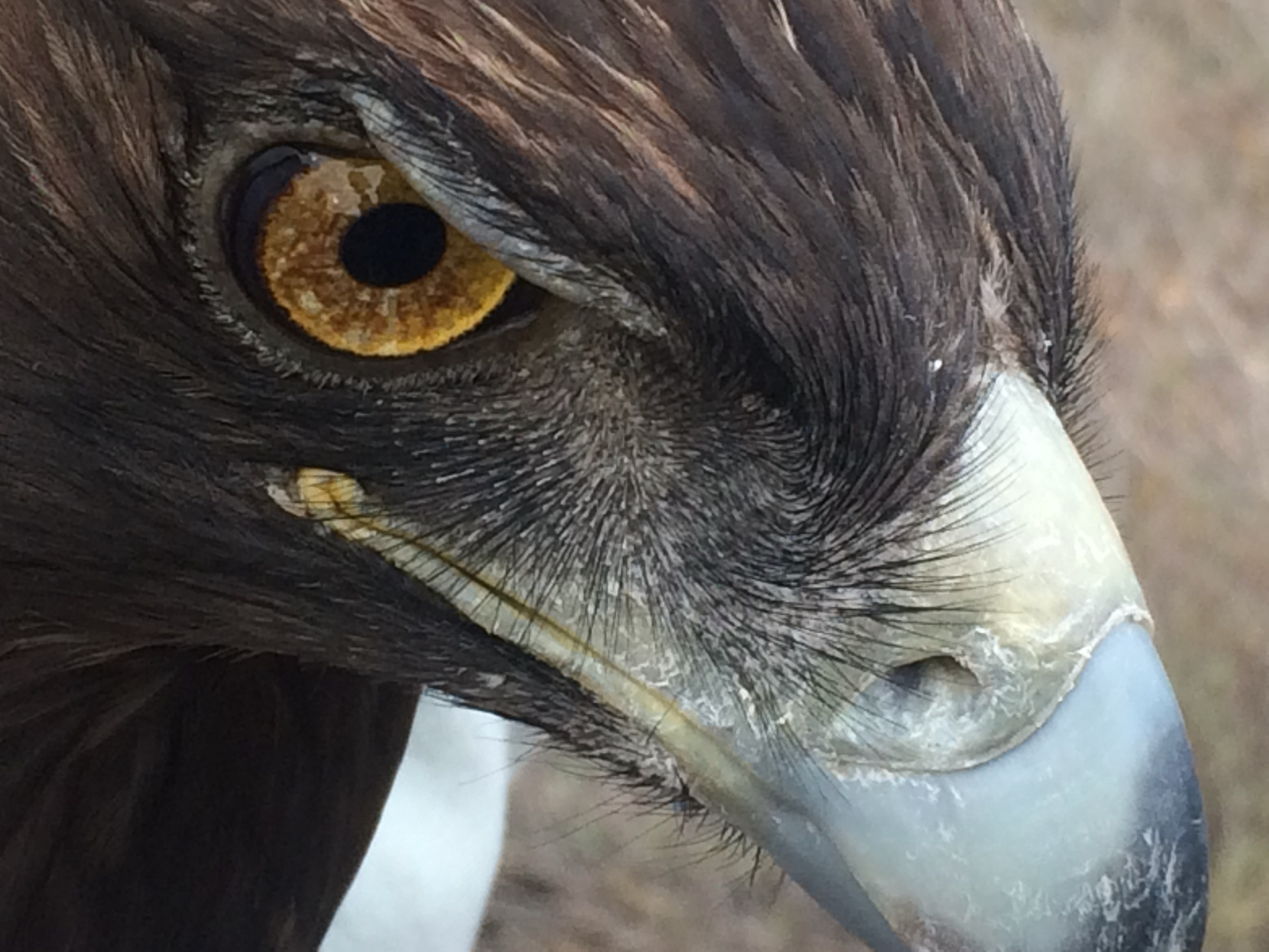
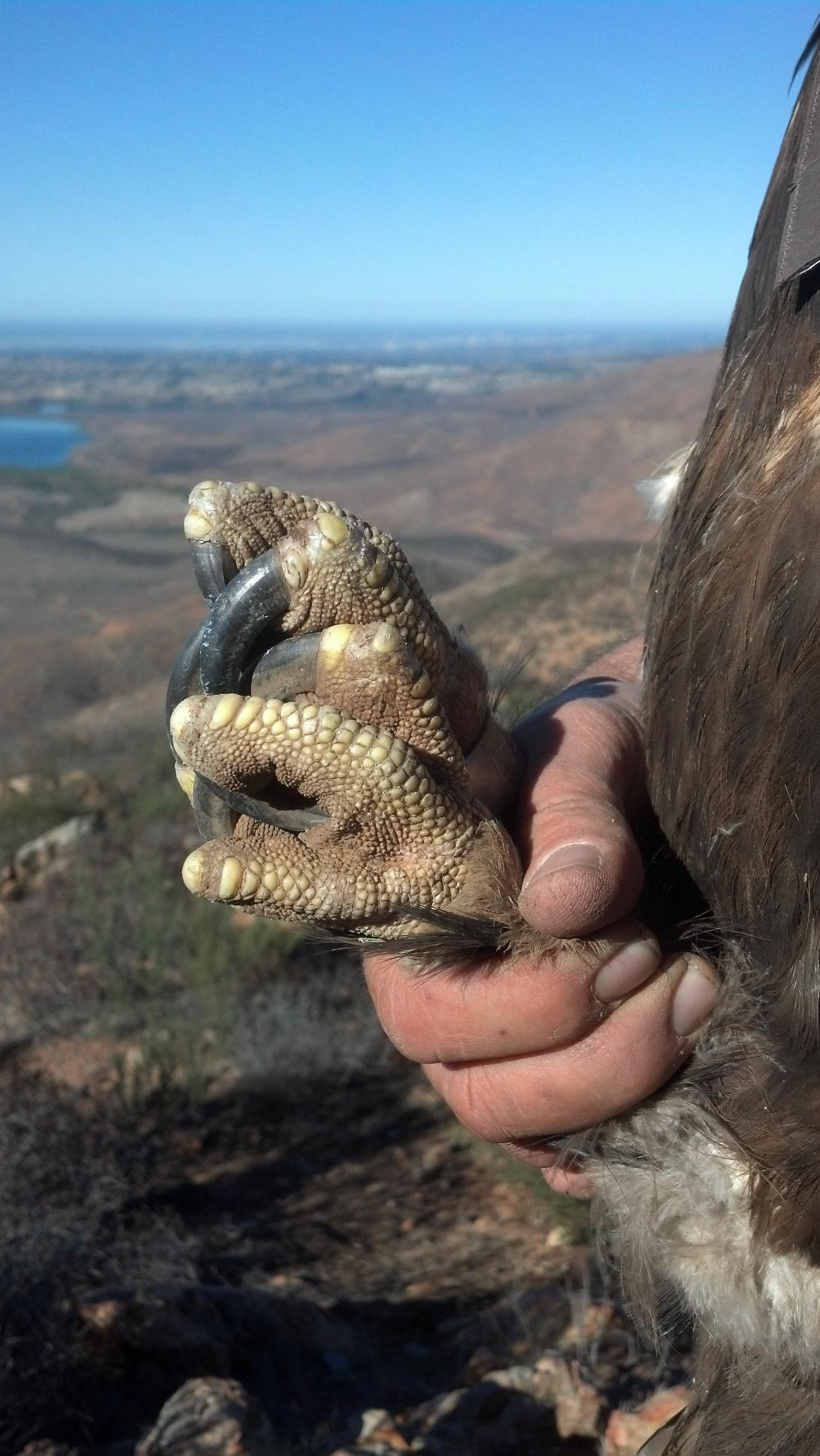
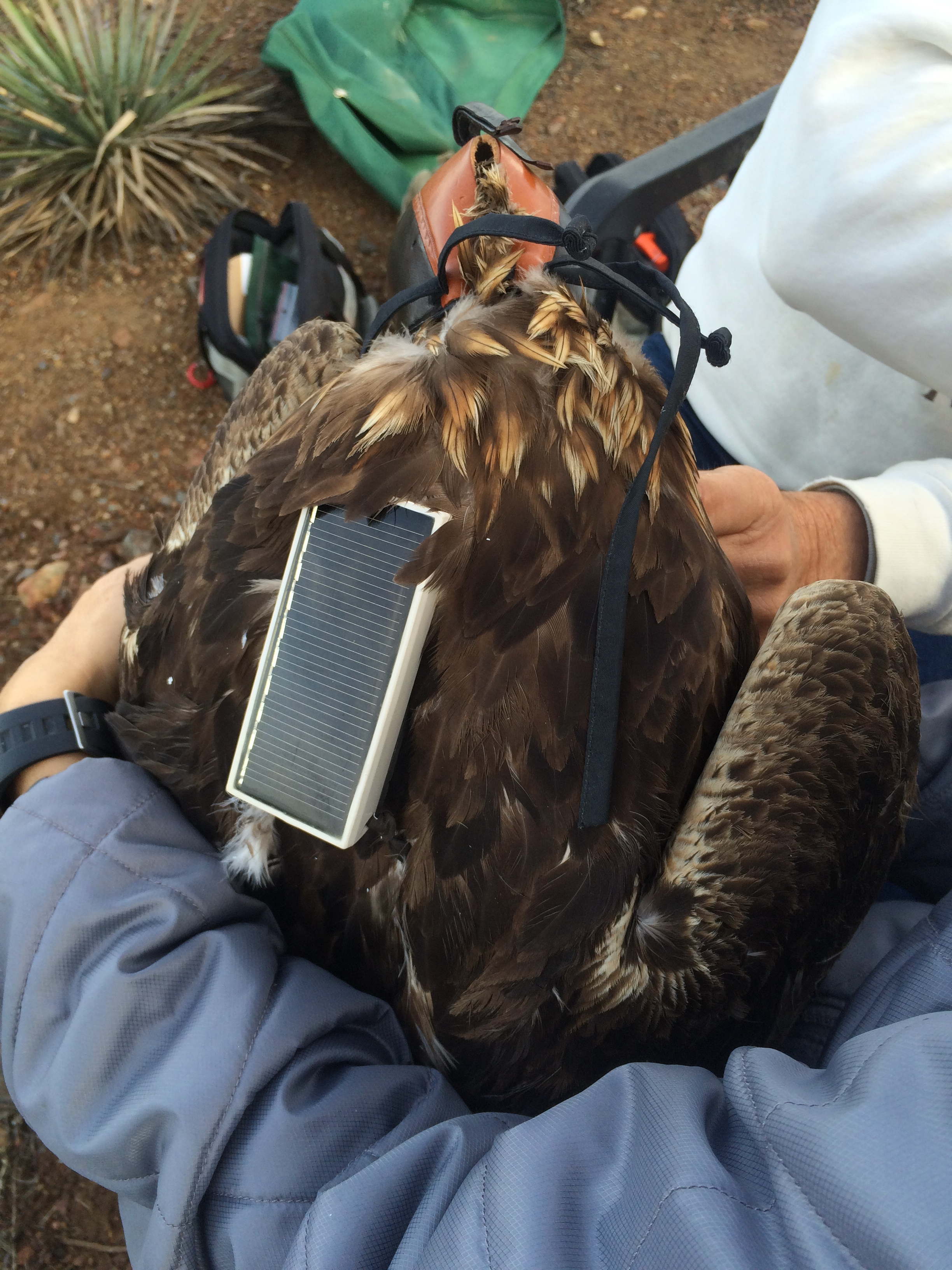
Once captured, eagles were fitted with a solar-powered GPS telemetry unit mounted on a backpack harness, weighed, measured, and released at the capture site.
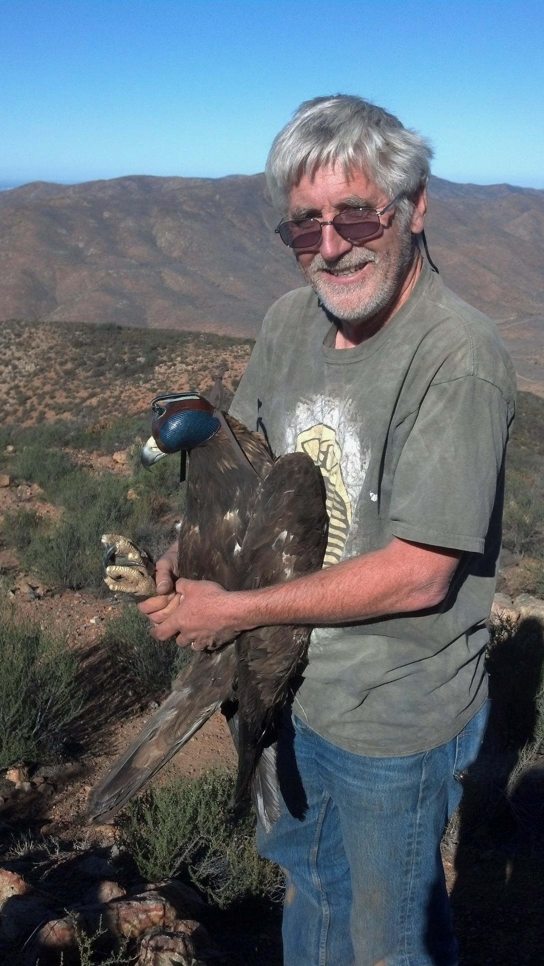
Releasing eagle M001 on Otay Mountain, San Diego County. 5 December 2014.
This video shows Pete Bloom preparing M001 for release and then me letting him go after fitting him with a GPS telemetry unit. Immediately after we released him, his mate (whom we also tracked) circled the ridge and joined him. (Video: Jeff A. Tracey)
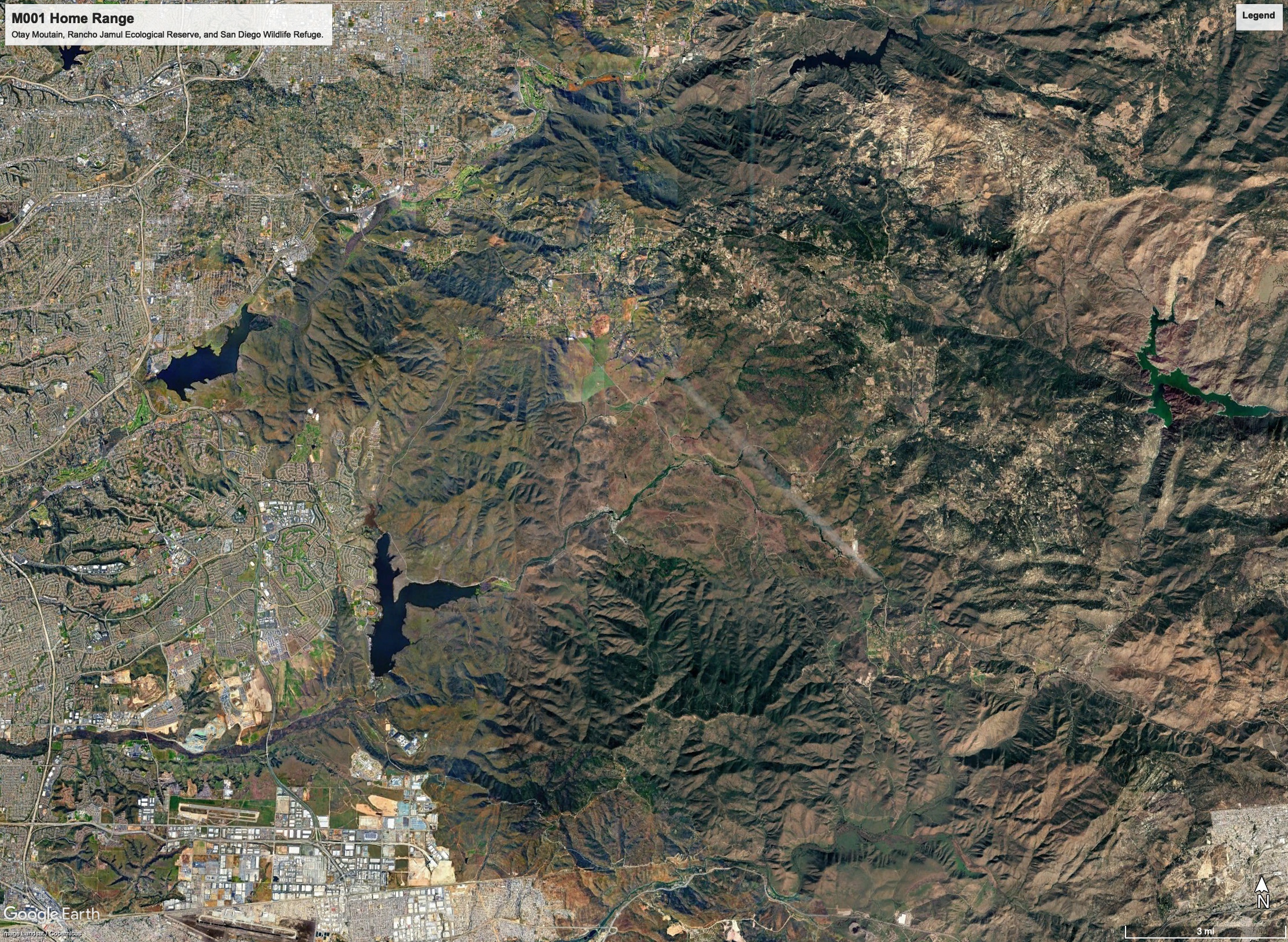
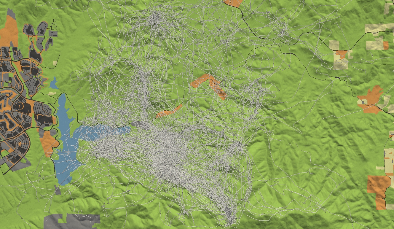
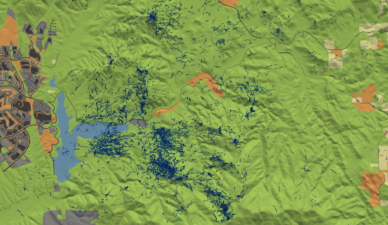
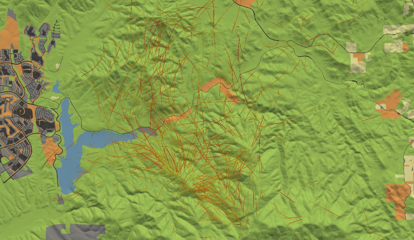
M001’s Territory
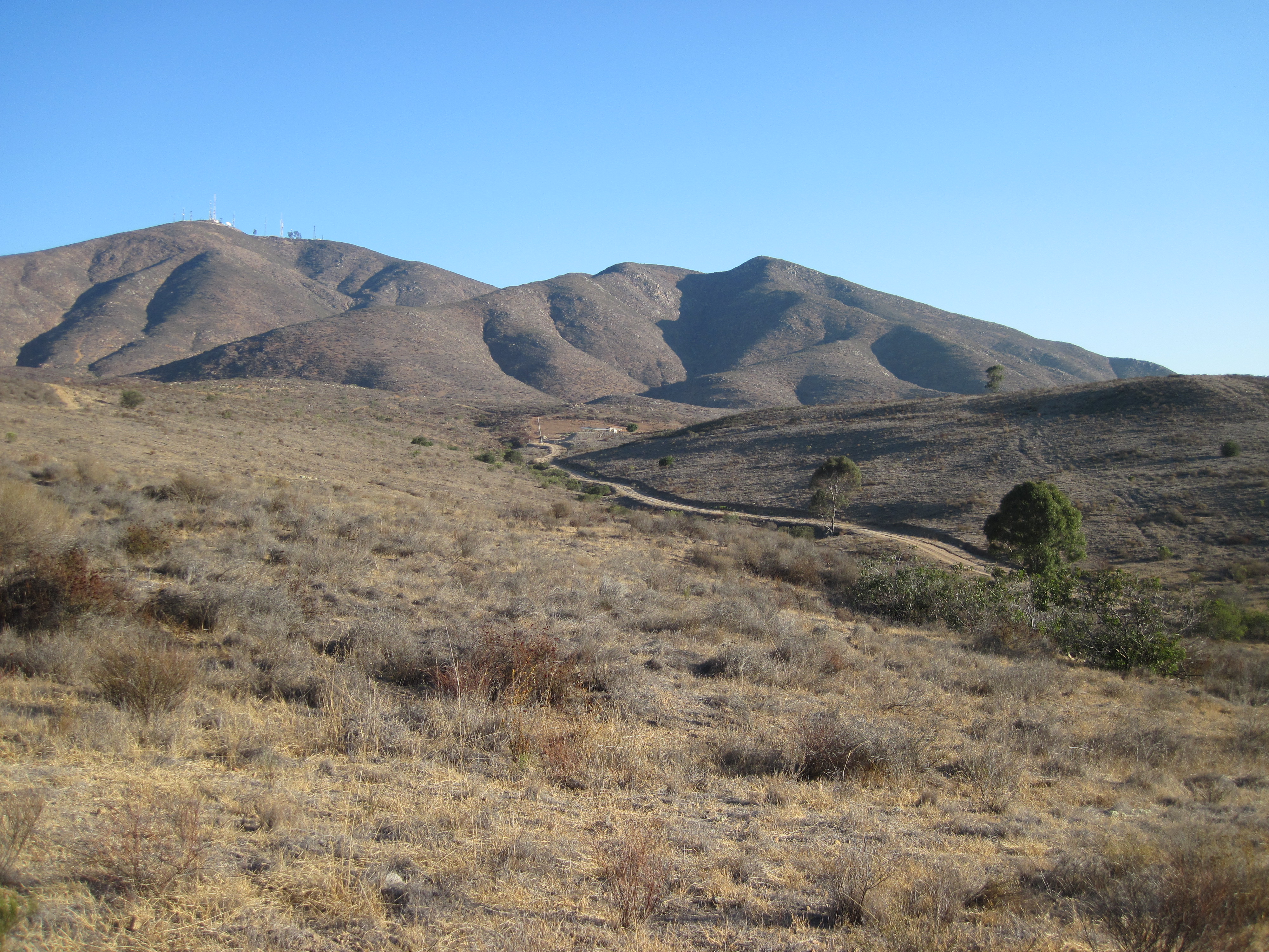
M001’s territory was centered on the north side of Otay Mountain and the surrounding wildlands — Rancho Jamul Ecological Reserve, San Diego National Wildlife Refuge — with urban Chula Vista and Otay Ranch pressing in from the west.
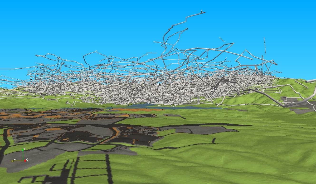
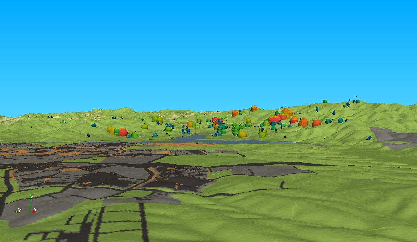
In order to visualize the movement of M001 (and other eagles in the area), I used ParaView to plot the movement trajectories in relation to terrain and land cover. The purpose ws to illustrate eagle movement in relation to proposed urbn developments in the area.
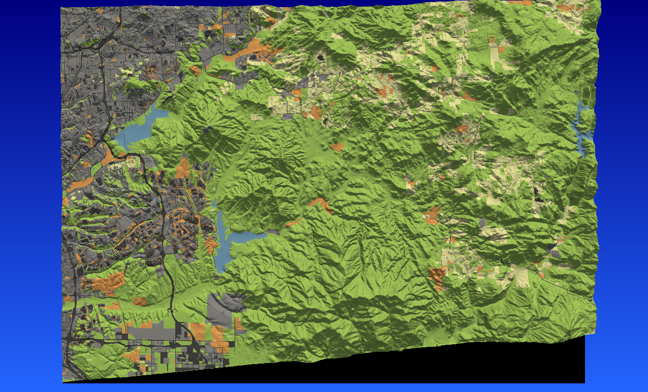
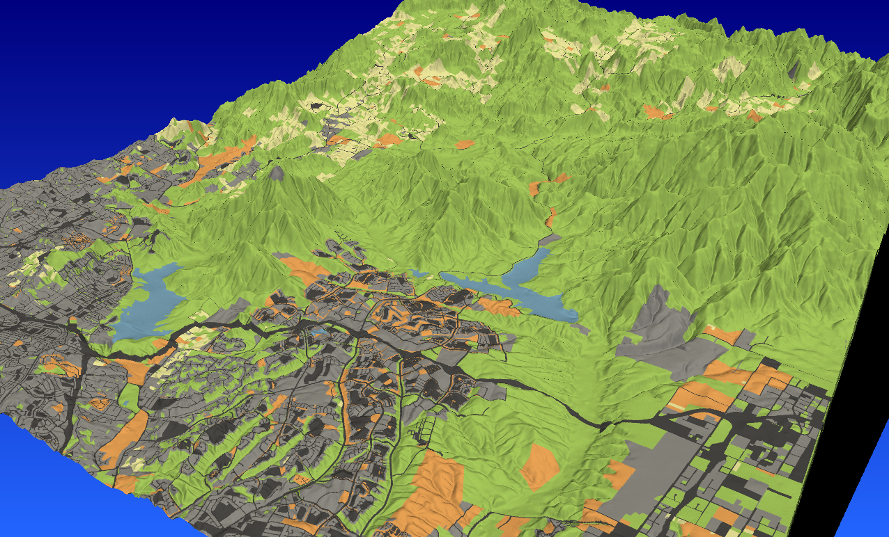
3D Telemetry Visualization of M001’s Movement
GPS location data for eagle M001, visualized in three spatial dimensions over the study area terrain. These visualizations were produced using ParaView with custom R code to export GPS data and MKDE outputs in VTK format.
Movement Animation
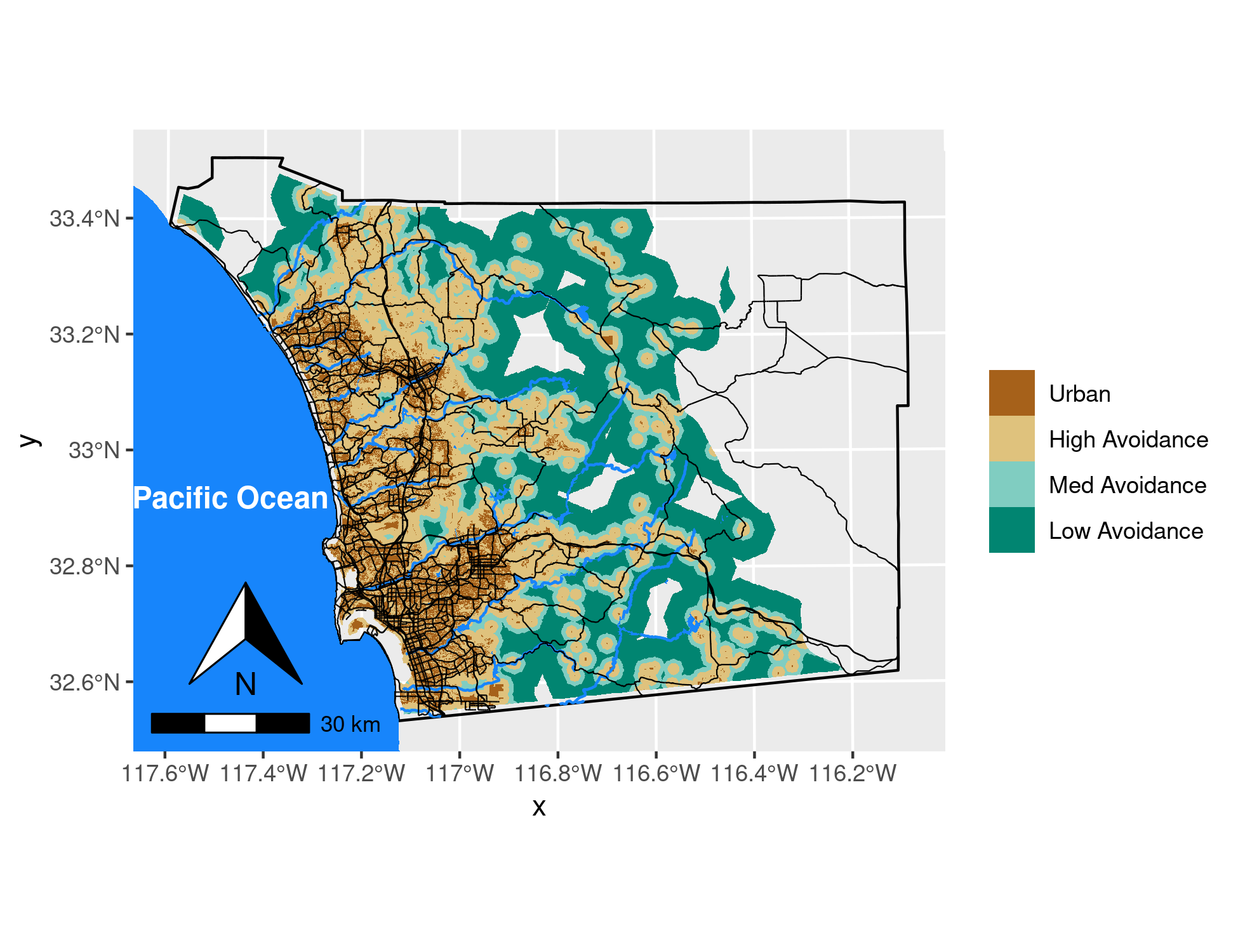
Habitat Selection and Urban Avoidance
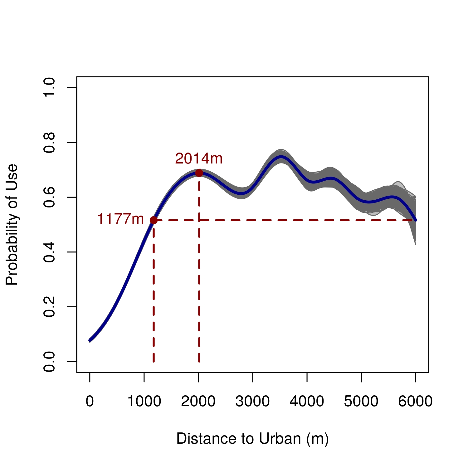
I built a habitat model so that we could better understand golden eagle movement in relation to the urban-habitat boundary and terrain. The results showed that golden eagles in San Diego County strongly avoid urban areas, with habitat use increasing sharply with distance from development. The relationship is non-linear: use probability rises steeply from the urban edge, peaks around 2km out, then levels off into wildland habitat.
Urban development in the study area grew substantially over the study period and is projected to continue expanding. The figure below shows how urban and exurban landcover changed from 1990 to 2014 and is projected to change by 2050, alongside the predicted log-probability of eagle habitat selection — the suitable habitat base is shrinking.
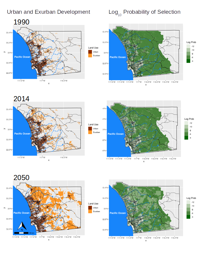
These maps of model predictions look only at the effects of urbanization on eagle space use, but other factors are involved, so their movements and territories are more restricted than the maps suggest.
Habitat Protection
The habitat selection analysis documented something that was already visible on the ground: the wildland east of San Diego was under serious development pressure, and golden eagles were responding to it. Nearly 70% of the Proctor Valley area — part of M001’s home range, sitting between San Diego National Wildlife Refuge and Rancho Jamul Ecological Reserve — faced development that would have fragmented the remaining coastal sage scrub and severed wildlife connectivity across the landscape.
In January 2024, The Nature Conservancy, California Department of Fish and Wildlife, California Wildlife Conservation Board, and U.S. Fish and Wildlife Service jointly acquired 1,291 acres in Proctor Valley, protecting that link and connecting over 60,000 acres of contiguous wildland. Golden eagles are among the species that use the area for foraging habitat.
The acquisition was led in part by Scott Morrison, director of conservation science for TNC in California, whom I met while he was doing his PhD field research and I was radio-tracking red diamond rattlesnakes at Mission Trails Regional Park for my MS in Biology.
Press release: USFWS, January 2024
The bottom line is that unless we protect their habitat and the connectivity throughout the region, we may well lose golden eagles in coastal southern California.
Papers
Wiens JD, Bloom PH, Madden MC, Kolar PS, Tracey JA, Fisher RN (2022). Golden eagle occupancy surveys and monitoring strategy in coastal southern California, United States. Frontiers in Ecology and Evolution 9: 665792.
Poessel SA, Woodbridge B, Smith BW, Murphy RK, Bedrosian BE, Bell DA, Bittner D, Bloom PH, Crandall RH, Domenech R, Fisher RN, Haggerty PK, Slater S, Tracey JA, Watson JW, Katzner TE (2022). Interpreting long-distance movements of non-migratory golden eagles: Prospecting and nomadism? Ecosphere 13(6): e4072.
Sur M, Woodbridge B, Esque TC, Belthoff JR, Bloom PH, Fisher RN, Longshore K, Nussear KE, Tracey JA, Braham MA, Katzner TE (2021). Linking behavioral states to landscape features for improved conservation management. Ecology and Evolution 11(12): 7905–7916.
Sur M, Duerr AE, Bell DA, Fisher RN, Tracey JA, Bloom PH, Miller TA, Katzner TE (2020). Relevance of individual and environmental drivers of movement of Golden Eagles. Ibis 162(2): 381–399.
Tracey JA, Madden MC, Bloom PH, Fisher RN (2020). A clarification on the effects of urbanization on Golden Eagle (Aquila chrysaetos) habitat selection. USGS Data Series 1128. https://doi.org/10.3133/ds1128
Tracey JA, Madden MC, Bloom PH, Katzner TE, Fisher RN (2018). Golden eagle (Aquila chrysaetos) habitat selection as a function of land use and terrain, San Diego County, California. USGS Open-File Report 2018-1067. https://doi.org/10.3133/ofr20181067
Tracey JA, Madden MC, Molden JC, Sebes JB, Bloom PH, Fisher RN (2020). Biotelemetry data for Golden Eagles (Aquila chrysaetos) captured in coastal southern California, February 2017–December 2019. USGS Data Series 1128. https://doi.org/10.3133/ds1128
Tracey JA, Madden MC, Sebes JB, Bloom PH, Katzner TE, Fisher RN (2017). Biotelemetry data for golden eagles (Aquila chrysaetos) captured in coastal southern California, February 2016–February 2017. USGS Data Series 1051. https://doi.org/10.3133/ds1051
Rapstine NI, Tracey JA, Gordon JM, Fisher RN (2019). Unsupervised Clustering of Telemetry Data. Proceedings of the International Conference for High Performance Computing, Networking, Storage and Analysis. IEEE Press. https://sc19.supercomputing.org/proceedings/tech_poster/tech_poster_pages/rpost221.html
Tracey JA, Madden MC, Sebes JB, Bloom PH, Katzner TE, Fisher RN (2016). Biotelemetry data for golden eagles (Aquila chrysaetos) captured in coastal southern California, November 2014–February 2016. USGS Data Series 994. https://doi.org/10.3133/ds994
Collaborators
- Pete Bloom — raptor biologist; eagle trapping and field work
- Todd Katzner — USGS Forest and Rangeland Ecosystem Science Center; eagle ecology and movement
- Robert N. Fisher — USGS Western Ecological Research Center; project PI
- Jeremy Sebes (played an instrumental role in the field work) and Melanie Madden (took over project manamgement after the first year or so of the project)